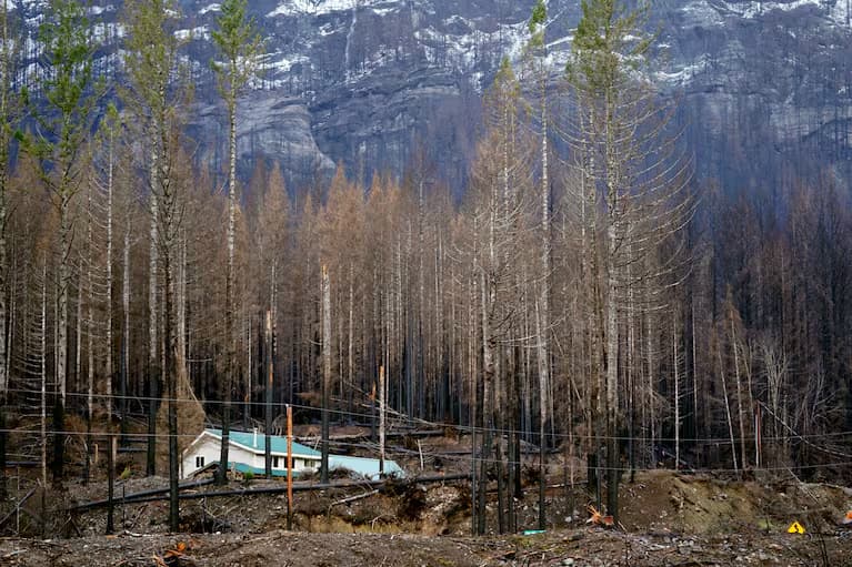
Oregon homeowners who live in certain high-risk wildfire areas defined by the state must now meet new building codes and reduce vegetation around their homes under new “wildfire hazard maps” unveiled Tuesday.
The release of the maps follows a record-breaking wildfire season last year and firestorms in 2020 that killed nine people and destroyed thousands of homes.
The state-developed maps — which will not affect homeowners’ insurance rates, under Oregon law — create new rules for those living in the most fire-prone areas that also border wildlands such as forests or grasslands. The provisions impact 6% of the state’s roughly 1.9 million tax lots, a reduction from an earlier version developed in 2022 but retracted after homeowners raised concerns that it would increase insurance premiums.
Wildfire seasons are growing longer and more intense due to climate change, and Oregon isn’t the only state grappling with how to manage the risk. Washington state and Colorado have also recently moved to address fire risk in their communities, and a new rule announced in California last week will require insurance companies to provide policies in high-risk wildfire areas in order to continue doing business in the state.
In Oregon, the new building and so-called defensible space codes will affect only about 106,000 tax lots. But experts say that’s an important step in identifying and protecting fire-prone areas as the state continues to contend with record-breaking wildfires.
Since 2020, blazes even burned up homes on the Oregon coast, just inland from the Pacific Ocean in areas once thought almost immune to fire because of a wetter, cooler climate.
“After 2020, we can’t pretend anymore that this is just an issue for southwest Oregon and central Oregon,” Andy McEvoy, a faculty research assistant at Oregon State University’s College of Forestry who worked on the map, told The Associated Press. “All of those events really cried out for a statewide — a truly statewide — strategy to respond to wildfire risk.”
Wind-fueled blazes over Labor Day weekend in 2020 were among the worst natural disasters in state history, killing nine people, burning more than 1,875 square miles (4,860 square kilometers), and destroying thousands of homes and other structures.
The 2024 wildfire season was also historic. It cost Oregon more than $350 million, making it the state’s most expensive on record, and it burned a record of nearly 3,000 square miles (7,770 square kilometers), largely on range and grazing land in the state’s rural east.
McEvoy said the maps will help officials aid communities most in need of wildfire resources. Reducing vegetation around homes to create a buffer zone of defensible space and installing certain fire-resistant features such as metal roofs or fiber cement siding can make a home more resilient to fire.
“If we manage our vegetation a certain way, if we build our structures out of certain materials, then we can increase the likelihood of that structure surviving,” he said. “But we’re not going to change the probability of the fire occurring in the first place.”
The two maps showing wildfire hazard levels and the wildland-urban interface were released by the Oregon Department of Forestry and developed by Oregon State University scientists.
Under a state law passed in 2023, insurers cannot use a wildfire hazard map produced by a state agency to cancel or decline to renew a homeowner insurance policy, or to increase premiums. However, McEvoy noted that most insurers have been developing their own wildfire risk models for a long time.
“There’s very little in this map that hasn’t been illustrated or represented in other products produced by researchers or the insurance community themselves,” he said.
Oregon fire officials and researchers modified the original wildfire hazard maps after receiving thousands of public comments and holding public meetings across the state. McEvoy said major changes included reducing the hazard status of irrigated farmland as well as hay and pasture lands. The latter are often irrigated during haying and grazed during much of the fire season, which reduces the vegetation fuels on the landscape.
California, Arizona and New Mexico have had wildfire hazard maps for years. Last year, lawmakers in Washington state ordered the creation of a statewide wildfire risk map, and in 2023, Colorado passed a law establishing a wildfire resiliency code board.
The adoption process for the defensible space codes, which will be overseen by the Office of the State Fire Marshal, and the building codes, which will be overseen by the Building Codes Division, won’t begin until after the appeals period for the wildfire hazard maps is complete. The Oregon Department of Forestry will notify landowners of affected tax lots.
