By Nathan Gilles. April 18, 2024. It’s said that the map is not the territory.
This statement, say critics, is especially true of the maps created by the U.S. Forest Service to inventory the nation’s largest carbon sinks: its mature and old-growth forests.
In April 2023, under pressure from the Biden administration, the Forest Service completed its first-ever nationwide inventory of mature and old-growth forests found on federal lands.
This inventory of older trees is part of an ambitious Biden administration plan to harness the power of our nation’s forests as a nature-based solution to the climate crisis.
The idea is simple: rather than cut older trees down, the Biden administration is proposing we leave many of them standing, allowing them to do what years of scientific research has shown older trees do very well: take climate change-causing carbon out of the atmosphere and store it for long periods of time.
Announced in December 2023, the awkwardly named “Land Management Plan Direction for Old-Growth Forest Conditions Across the National Forest System” has been widely lauded by environmentalists and many scientists as a long-overdue step to help address the nation’s over-sized carbon footprint.
The nationwide forest plan is expected to lead to revisions of local forest plans throughout the country, including the Northwest Forest Plan governing Washington, Oregon and sections of Northern California.
But whether the nation’s older trees will be enlisted in the fight against climate change and spared the chainsaw could depend on knowing where those trees are.
And that, according to both critics of the Forest Service and the Forest Service itself, is not something the Forest Service’s inventory and mapping can do, because these maps are just not detailed enough to be used for management purposes on a stand-by-stand basis.
A study written by Forest Service scientists and published in August 2023 in the journal Forest Ecology and Management hints at this fact.
The study’s authors write that although the maps they created contain “a high degree of accuracy. … Identifying mature and old-growth forests in a stand management context will likely require additional measurements, adjustments to criteria at local scales, and incorporation of social and traditional knowledge within a consistent definition framework.”
In other words, the maps show the forest but not the trees, per se.
‘Low-res’ maps
The Forest Service’s mature and old-growth inventory used data on trees collected at individual forest plots that are part of the agency’s Forest Inventory and Analysis, a long-term scientific monitoring effort designed by the Forest Service to assess the health of the nation’s forests.
Data from the FIA program goes back decades. These data, and the FIA program generally, are widely respected and used by scientists both in and out of the Forest Service.
Nonetheless, FIA has its limitations, according to Richard Birdsey, retired Forest Service scientist turned senior scientist at the nonprofit Woodwell Climate Research Center.

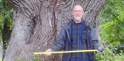
Dr. Richard Birdsey. Photo: Woodwell Climate Research Center
Based in Massachusetts, the Woodwell Climate Research Center funds scientific research related to climate change. Many of its scientists have been critical of the Forest Service and its practices.
“The FIA data is adequate for looking at large areas, maybe a whole state or a group of national forests. But there’s just not enough FIA sample plots in the typical old-growth stand to characterize it or monitor it carefully,” says Birdsey, who in addition to spending 15 of his 40 years at the Forest Service working on the FIA program has also conducted his own analysis of the carbon-storing potential of America’s older forests.
“[FIA is] a terrific program and really is a backbone for policies,” says Birdsey. “But it’s a little less effective when trying to monitor what’s happening at smaller scales or at the project scale. And that’s where a lot of public interest is.”
Here’s the problem. While the Forest service has 355,000 FIA plots (on public and private lands) in forests across the United States, the FIA plots themselves are small, covering approximately two-and-half acres each.
The plots are also miles away from each other, with one plot every 6,000 acres, or nine square miles, of forested land.
This leaves big gaps in the available data set, gaps that need to be filled with scientific guesswork that has to come from other sources of data.
What you get from this is a big picture look at the forest, but not a detailed one.
And this, says Birdsey, is exactly what the Forest Service ended up producing in 2023.
The Forest Service mature and old-growth forest inventory maps were created at what’s called a “fireshed” scale.
Firesheds are 250,000 acres each, or roughly 390 square miles.
This means a single 390-square-mile fireshed gets a single classification, for instance, “Moderate Mature, High Old Growth” or “High Mature, Moderate Old Growth,” as can be seen on an interactive online map displaying the agency’s mature and old-growth data.
By most scientist standards, this “resolution” is considered “low” or “coarse,” according to Birdsey and other scientists.
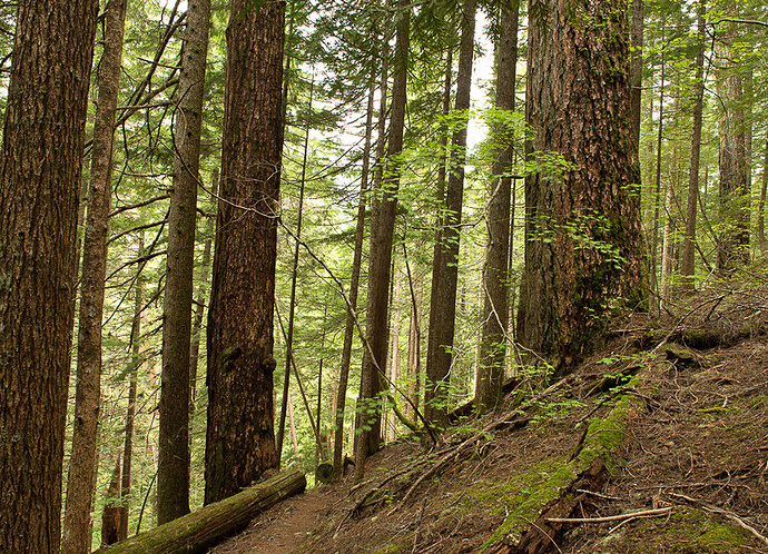
Aging well: This stand of Douglas fir (and other species) includes trees of multiple ages. Photo by Jurgen Hess
This low resolution has been widely criticized not only by scientists but also by environmentalists hoping to protect mature and old-growth forests, says Steve Pedery, conservation director at the Oregon-based environmental nonprofit Oregon Wild.
“The Forest Service maps did give a total picture in terms of the volume [of mature and old-growth trees], but they were so vague that you couldn’t actually identify any particular specific stand of old-growth anywhere,” says Pedery.
Pedery says the low-resolution maps could make protecting older trees more difficult.
For its part, the Forest Service admits its maps are vague and can’t be used to manage individual stands, but the agency doesn’t necessarily see this as a bad thing, according to Jamie Barbour, assistant director for adaptive management at the Forest Service’s Monitoring and Analysis Team, which oversaw the implementation of the mature and old-growth inventory.
“We didn’t want to create the impression that we knew exactly where these clumps of old forest were because that would have ramifications that might not be very useful,” says Barbour, adding that the agency wanted only “to present an idea of where large accumulations of older forests were.”
Asked what he meant by “ramifications,” Barbour responded, “People misinterpret things. If we’re saying that a specific small area is mature old growth and it’s not, then that could lead to disputes about how to manage it.”
Barbour says high-resolution mapping of mature and old-growth forests should ideally happen at the local level. Though, he says, the Forest Service is also exploring using a NASA-led effort called “GEDI,” a project that is literally out of this world.
GEDI: Monitoring old-growth from space
“GEDI” stands for the Global Ecosystem Dynamics Investigation—which, yes, is a reference to “a galaxy far, far away” and is pronounced “Jedi.”
Befitting its namesake, GEDI uses a high-resolution laser system known as LiDAR to map the Earth’s surface.
The project’s LiDAR system is located on the International Space Station.
The GEDI system can observe “nearly all tropical and temperate forests.”
The project’s goal is to “provide answers to how deforestation has contributed to atmospheric CO2 concentrations, how much carbon forests will absorb in the future and how habitat degradation will affect global biodiversity,” according to its website.
The NASA-led effort has been used to map old-growth trees in Australia but was not used as part of the Forest Service mapping project, despite the fact that GEDI data for U.S. forests were available at the time.
However, GEDI might be used by the Forest Service to continue monitoring older forests, at least according to promotional material posted by NASA on its website and on YouTube.
This material suggests that adding GEDI to the Forest Service’s mapping effort will “soon” enable the public to “view some of these [old-growth] forests like never before” and help “fill in those spatial gaps” that FIA data and the Forest Service’s current inventory was unable to fill.
Exactly if and when GEDI will be used by the Forest Service is unclear.
GEDI project lead, Ralph Dubayah, professor of Geographical Sciences at the University of Maryland, couldn’t be reached for comment.
The project’s LiDAR system is also currently not in use on the ISS. Instead, it’s being stowed away to make room for a Department of Defense project, according to Barbour.
GEDI data won’t provide a complete picture of what’s out there, says Barbour, but echoing NASA’s promotional material, he says it could help fill in the gaps between FIA plots.
‘Mature’ trees needs protection, too
Beverly Law, a retired forest ecologist at Oregon State University’s College of Forestry and leading researcher on how to harness the carbon-capturing power of older trees, says she was also disappointed with the Forest Service’s inventory of mature and old-growth trees.
In 2018, Law came under fire from the timber industry following the publication of her study in the Proceedings of the National Academy of Sciences.
The study demonstrated that the state of Oregon could sequester more carbon and slow climate change if it slowed the rate at which it harvested its forests.

Beverly Law. Photo: Lawrence Berkeley National Laboratory
Law is impressed with the Biden administration’s efforts to push the Forest Service in the direction of carbon storage.
But she worries about how the plan will be implemented by an agency that historically has had to be ordered to conserve rather than log the nation’s trees.
“It’s the best move that’s been made by any administration, ever,” says Law of the old-growth forest plan. “But the devil’s in the details in how it’s carried out.”
In February, Law was one of over 190 scientists who study the carbon-capturing potential of older trees to sign an open letter to the Biden Administration requesting it immediately “direct the Forest Service and BLM to suspend all timber sales in mature and old-growth forests, and refrain from proposing new timber sales in these forests” until the environmental impact statements required by law to implement the old-growth forest plan are completed.
One of those devilish details Law and others are concerned about is the possibility that the Forest Service is now trying to sidestep its obligation to protect both mature and old-growth trees.
As critics pointed out in December 2023, when it was published, the Land Management Plan Direction for Old-Growth Forest Conditions Across the National Forest System, while creating nationwide protections for old-growth forests, fell short of also providing broad protections for mature forests.
Because many mature tree stands are now old enough to be carbon-capturing powerhouses in their own right, and because many are now just decades away from being classified as old-growth, many scientists, Law among them, argue that the lack of protections for mature trees is a major loss both for trees and for fighting the climate crisis.
Leaving out mature trees, they say, also violates the intent of the larger push to use the nation’s forests to sequester carbon, a push that doesn’t originate with the Forest Service but with two executive orders issued by the Biden Administration.
The first executive order, EO 14008, was signed shortly after President Biden’s inauguration in 2021. It directs federal agencies to protect 30% of the nation’s lands and waters by 2030.
The second executive order, EO 14072, was issued in April 2022 and directs the Department of Agriculture (which contains the Forest Service) and the Bureau of Land Management to create a national inventory of mature and old-growth forests found on federal lands as part of a larger effort to use these forests to, among other things, “retain and enhance carbon storage.”
According to the Forest Service’s own estimates, while old-growth forests cover just 17% of the federal lands they inventoried, mature forests can be found on 45% of surveyed lands.
Barbour, however, takes issue with claims that his agency is no longer concerned with mature forests as a way to fight climate change.
“We would like to manage [forests] for a suite of conditions, some of which are older forests, and we’re trying to understand where we can maintain forests for a very long period of time,” says Barbour.
Barbour says ultimately the goal of carbon storage needs to be balanced against the need to “provide economic opportunities in rural communities” through ongoing forest management.
As for the Forest Service’s inventory of mature and old-growth forests, Law, who helped design the Forest Service’s FIA program, says one important question is why it took so long for the Forest Service to develop official mature and old-growth maps when the scientific community more generally has been doing this kind of analysis for decades.
“We’ve been waiting for this since before [President George W.] Bush, and even now it’s like, what the heck took so long?” says Law.

