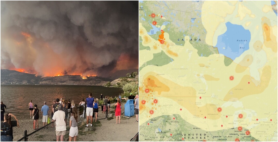
As wildfires continue to burn, with the worst in BC and the Northwestern Territories, smoke will continue to make its way across the most populous parts of southern Canada.
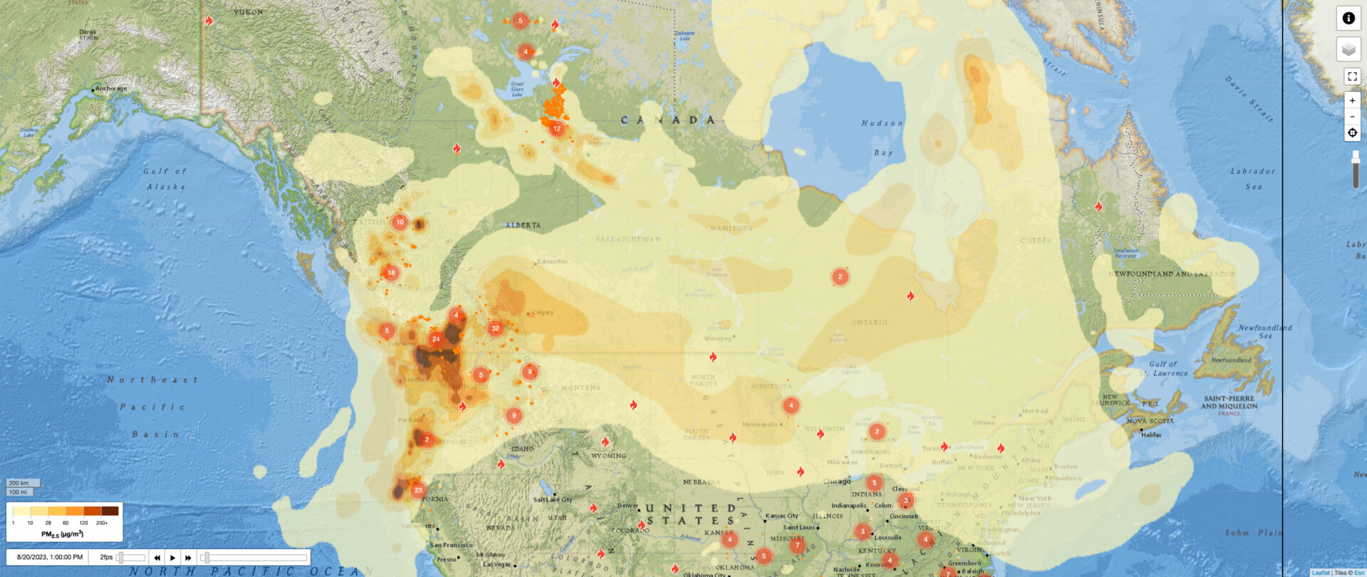
According to a forecast by Firesmoke Canada, over the next few days, the smoke will continue to spread as far east as the Atlantic Ocean, as far north as the Arctic Circle, and as far south as the US.
As of Sunday, August 20, smoke from the BC and Northwestern Territories wildfires has been detected in Toronto, Montreal, and Fredericton.
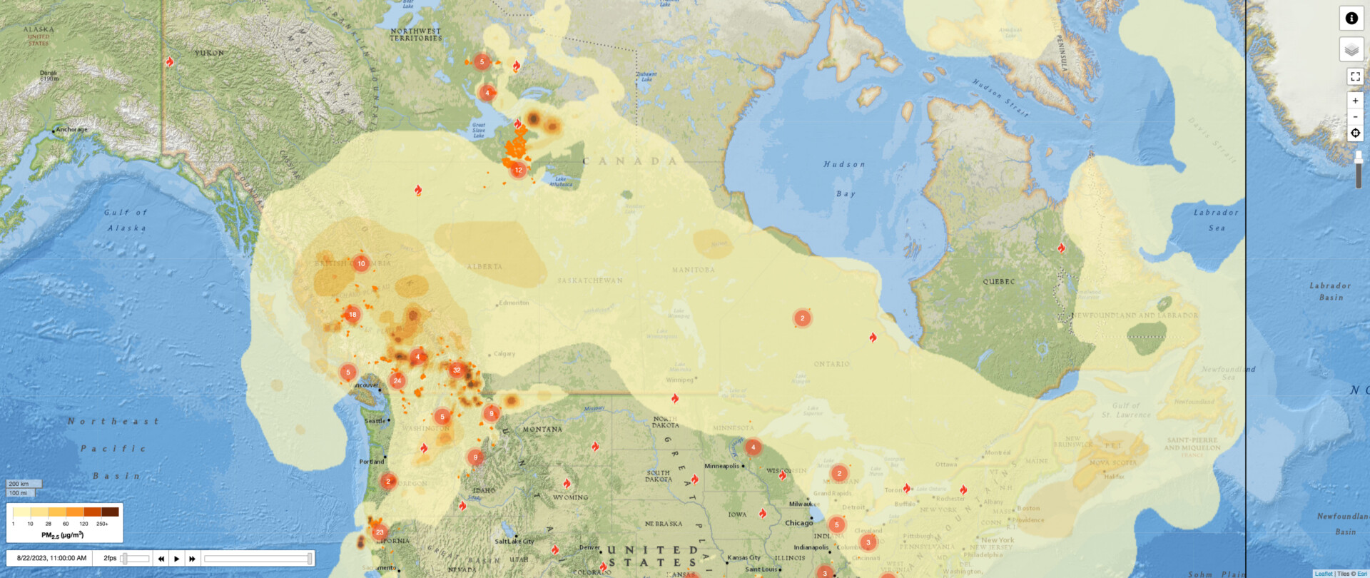
By Tuesday, August 22, Nova Scotia and Newfoundland and Labrador could be completely blanketed in smoke. The air quality will vary by region, and despite the smoke spreading, the risk will remain relatively low.
However, the same can’t be said for parts of Alberta.
According to Environment and Climate Change Canada (ECCC), cities like Airdrie and Calgary will experience high levels of air pollution throughout Sunday. However, by the evening, that number is expected to drop from 7 to 4.
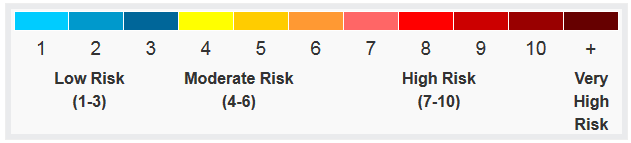
In parts of BC, such as Central Fraser Valley, Central Okanagan, North Okanagan, Sparwood, and Whistler, the risk remains very high, with each area registering an air quality health index of 10+.
It’s the same situation in the town of Fort Smith in the Northwestern Territories, where an evacuation order remains in place.
Learn more about the health risks of air pollution here.